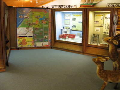
Visitors to the museum are now able to "explore North Berrien" using an interactive historical map of the area. This new permanent exhibit is a color graphic panel that measures 69" x 77" and is located in the main museum gallery. The map provides an overview of roads, waterways, and North Berrien communities. Visitors will find eight images from the museum's collection that lift to reveal a detailed explanation of the photograph.

"Explore North Berrien" will be particularly beneficial to school groups and children who visit the museum. The map will help young people grasp the concept of local geography through the use of recognizable landmarks. Classes will begin their tours in front of the map for a visual overview of our community history. Out-of-town visitors are another group that will benefit from this new exhibit. Those new to North Berrien will be able to see the area they are visiting including Paw Paw Lake, Lake Michigan, and the orchards of Bainbridge Township.
Under the direction of museum staff, graphic design fro the exhibit was completed by Robin Maxon of Maxon Graphix in St. Joseph. The display was printed and installed by Anchor Signs in Benton Harbor. Please stop in during open hours to explore our latest addition to the museum gallery.
No comments:
Post a Comment